


If you’ve ever imaged what Toronto looked like over the past 200 years, you might be surprised to know that at one point in time, “everything north of Queen Street was farmland or forest and all the historic lands south of Front Street were just lake.” It’s revelations like these that are now easily accessible to public thanks to the work of Toronto resident and amateur historian Nathan Ng. Over the past few years Ng has been unearthing and digitizing maps of Toronto dating back to its establishment in the 1700s and up to the early 20th century. The maps, which are in the public domain have up until now been available to the public, but only if you were willing to dig through the collection at The Toronto Reference Library or the City Archives.
Ng’s Historical Maps of Toronto website now amalgamates of large collection of high resolutions images of these maps, accompanied by commentary sourced largely from the 1984 ROM exhibit text, Mapping Toronto’s First Century 1787-1884, for easy public access. Launched earlier this year, the website separates the maps into four chronological categories of Toronto’s development: Establishment: 1787-1820, Expansion: 1820-1850, The Boom: 1850-1862, and the The Emerging Metropolis: 1862-1902. Ng has since also launched a site dedicated to historical maps of the Fort York and Garisson Commons, which at one point covered most of what is now Liberty Village.
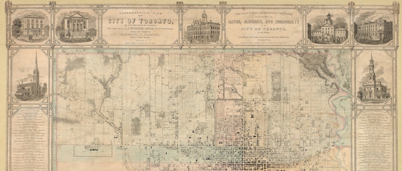
Detail of Osgoode Hall from Sir Sandford Fleming;s 1851 Map of Toronto. Image via Toronto Public Library Detail of Toronto’s Lunatic Asylum, located in the same location as the present Centre for Addiction and Mental Health on Queen Street from Sir Sandford Fleming;s 1851 Map of Toronto. Image via Toronto Public Library Map of Toronto, published by Willing & Williamson, Drawn by A.T. Cotterell, C.E. Toronto. Revised by H.J. & W.A. Browne, P.L.S. Toronto to April 1, 1878. Image via Toronto Public LibraryFind more maps on The Historical Maps of Toronto website.
[via Toronto Star and Inside Toronto]
____
Eva Voinigescu is an intern at Toronto Standard. Follow her on Twitter @EvaVoinigescu.
For more, follow us on Twitter at @torontostandard and subscribe to our Newsletter.